Back Mont Titano AN مونتي تيتانو Arabic جبل مونتى تيتانو ARZ Монтэ-Тытана Byelorussian Mont Titano Catalan Monte Titano CEB Monte Titano Czech Monte Titano Welsh Monte Titano Danish Titano German
| Mount Titano | |
|---|---|
 Monte Titano and three fortresses on top of it can be seen from many kilometers away. | |
| Highest point | |
| Elevation | 739 m (2,425 ft)[1] |
| Prominence | 189 m (620 ft)[1] |
| Isolation | 5.82 km (3.62 mi) |
| Listing | Country high point |
| Coordinates | 43°56′06″N 12°27′00″E / 43.93500°N 12.45000°E |
| Geography | |
| Location | San Marino |
| Parent range | Apennines |
| Official name | San Marino Historic Centre and Mount Titano |
| Type | Cultural |
| Criteria | iii |
| Designated | 2008 (32nd session) |
| Reference no. | 1245 |
| Region | Europe and North America |
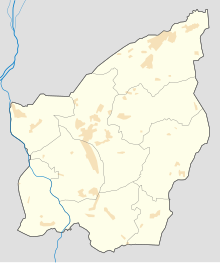
Monte Titano ("Mount Titan")[2] is a mountain of the Apennines and the highest point in the country of San Marino. It stands 739 m (2,425 ft) above sea level[3] Its peak is located within the municipal limits of the country's capital, San Marino, immediately east of the urbanized area.
It was inscribed as a UNESCO World Heritage Site in 2008 under the combined title "San Marino Historic Centre and Mount Titano". Inscribed under reference no. 1245 criteria iii, the two together encompass an area of 55 ha with a buffer zone of 167 ha. It encompasses Mount Titano and the other structures such as the fortification towers, walls, gates and bastions, as well as a neo-classical basilica located on it and its slopes forming a small but unique urban conglomerate.[4][5]
Straddled on the ridge of Mount Titano is the city of San Marino of the Republic of San Marino, the history of which dates from the early 4th century. According to the legend related to the Mount and its precincts, a small monastery existed on top of the Mount during the 8th century. The mountainous landscape provides excellent views of its surroundings, and its isolated location ensured the needed seclusion for San Marino to survive as a Republic over the past several centuries.[5][6]
Italian people often call the peak Monte Brugola, because of its shape apparently similar to a hex key, if observed from the Po Plain.[7]
The mountain has three peaks; on each is one of The Three Towers of San Marino. Saint Marinus is always represented with Mount Titano in his hands.[6][8][9][unreliable source?]
- ^ a b "Mount Titano" on Peakbagger.com Retrieved 30 September 2011
- ^ Spink & Son (1898). The Numismatic circular (in Italian). Vol. 6–7. p. 531.
- ^ Official Italian 1:25,000 mapping; other sources give slightly higher figures.
- ^ "San Marino Historic Centre and Mount Titano". UNESCO.org. Retrieved 2010-11-03.
- ^ a b "San Marino" (PDF). UNESCO.org. Retrieved 2010-11-03.
- ^ a b "Travel & Geography: Mount Titano". Encyclopædia Britannica. Retrieved 2010-11-03.
- ^ "Il Ponticello | Monte Titano, il balcone dell'Adriatico" (in Italian). Retrieved 2023-02-26.
- ^ Haggett, Peter (2002). "Encyclopedia of World Geography". Encyclopedia of world geography, Volume 11. Marshall Cavendish. p. 1461. ISBN 0-7614-7300-9.
- ^ "Geography of San Marino". How Discoveryworks: A Discovery Company. 2008-06-16. Archived from the original on 2011-10-03. Retrieved 2010-11-03.
